2| Collecting Data
First I looked to find the data I will be using. I used data from two main official websites Datashom and IMCCE.
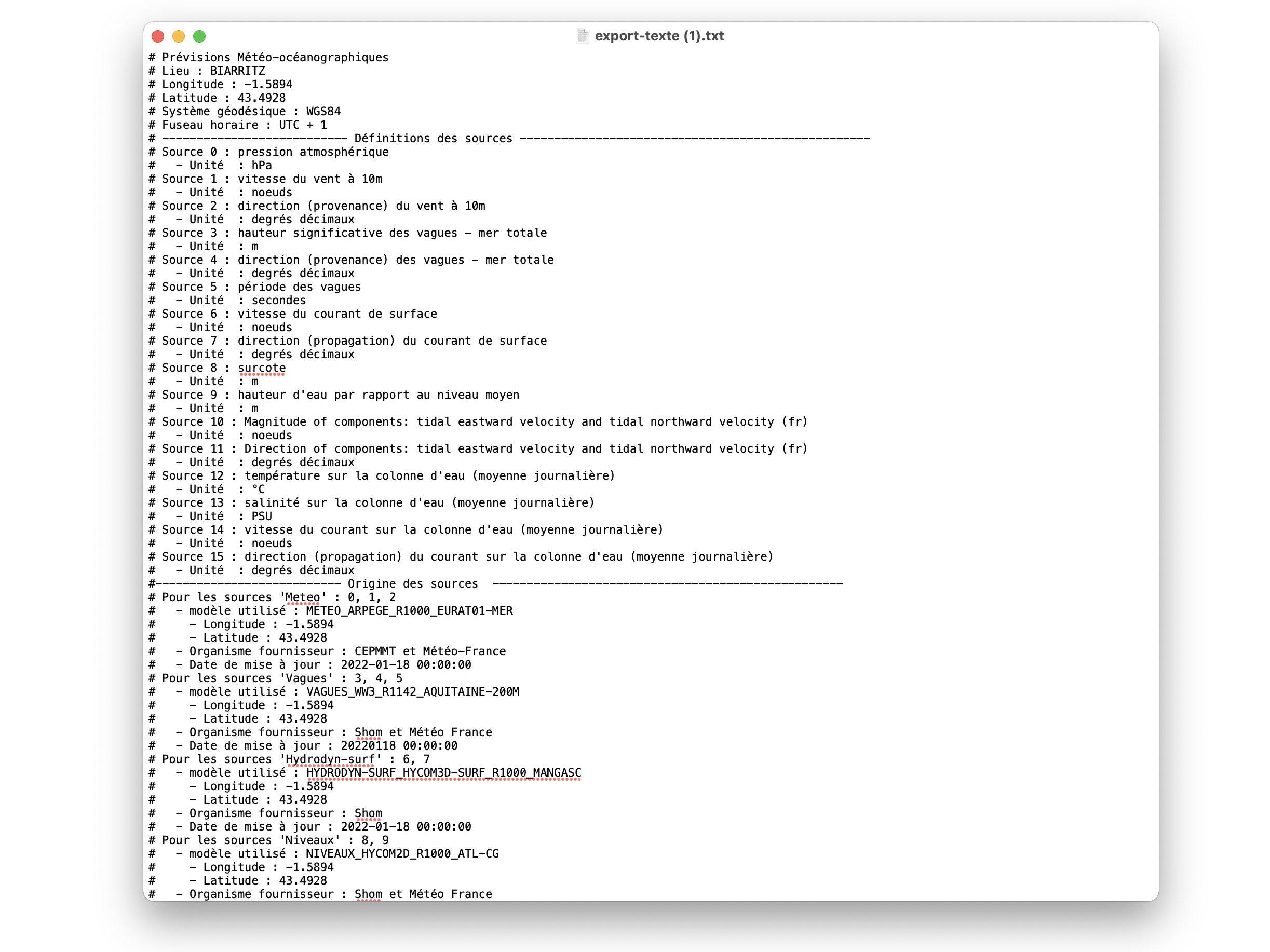
DATA Shom
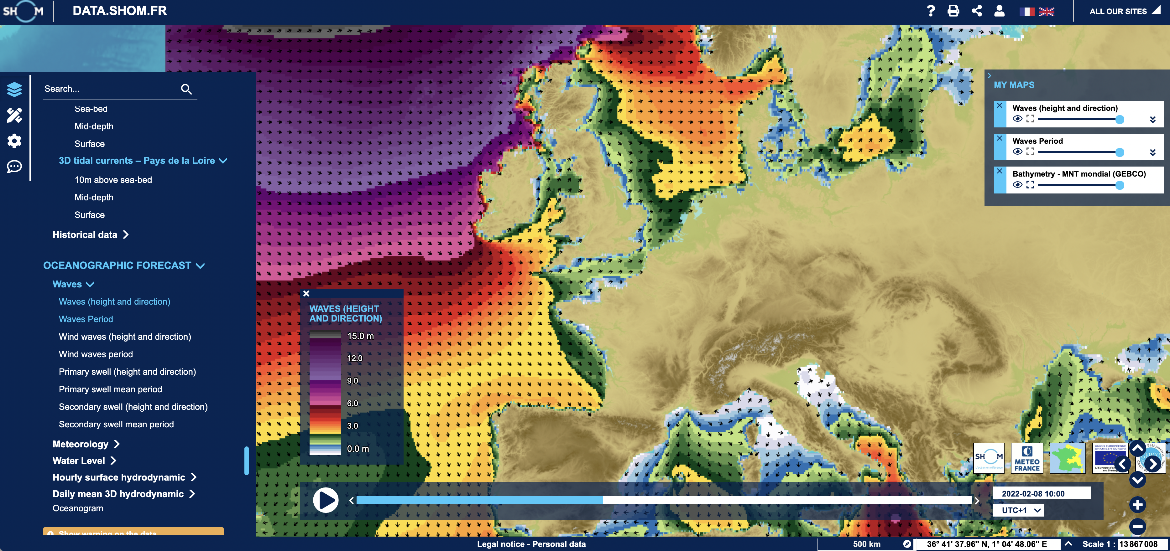
I used the data from the online live catalog of data.shom.fr: an online platform for coastal forecasts, from Shom and Météo-France models.
Oceanographic forecasts come in two forms: maps and oceanograms
- Oceanographic forecast maps:
The forecast maps provide the spatial distribution of past and future wind, wave, current, temperature and water salinity conditions at different scales from the global ocean to the European and French coasts depending on the parameters.
The daily averages of temperature, salinity and currents are also available at depth.
Oceanographic forecasts can be displayed and analyzed directly online and interactively. In addition, they can be combined with : cartographic backgrounds, HR bathymetries, tidal current atlases, legal limits and areas of interest, etc.
.
- The maps are an interesting point to start on but I needed the pure data- numbers so I used the oceanograms:
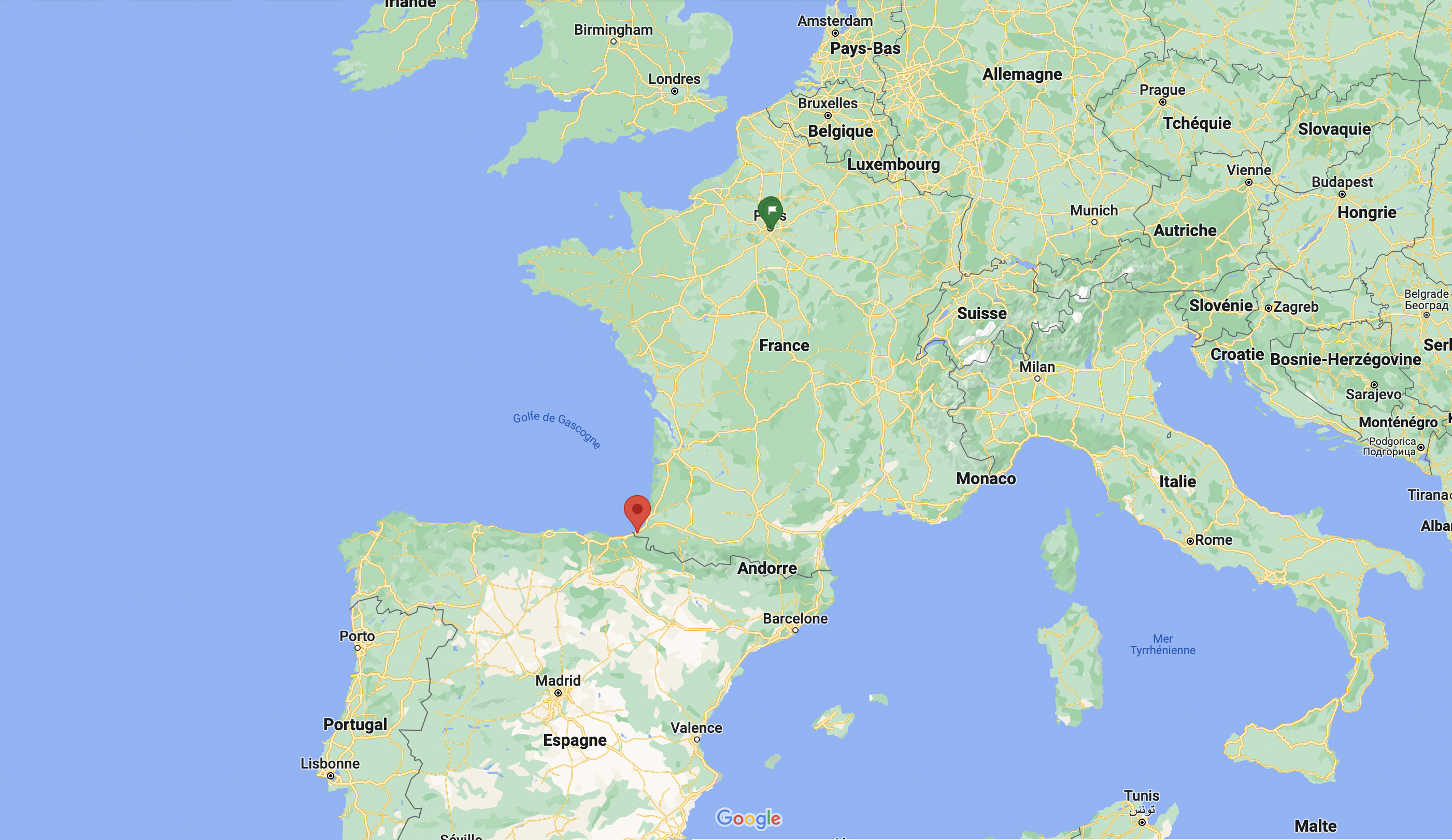
I specifically used the data from the Oceanograms from my home town Bayonne/Biarritz/Saint-Jean-de-Luz:
The oceanograms provide the evolution, over the day and the next 4 days, of the various meteo-oceanographic parameters at a specific location. They make it possible to compile in 1 page, on the point of your choice, the forecasts of each parameter, resulting from the models of Shom and Météo-France, in the form of curves or series of values.
To guide the user, a few spots are offered at the most representative geographical positions of the stretches of coastline.
The user can also click between the predefined points or further offshore to query the forecasts available at the selected geographical position.
A tab also allows you to view the daily averages of temperature, salinity and currents at depth.
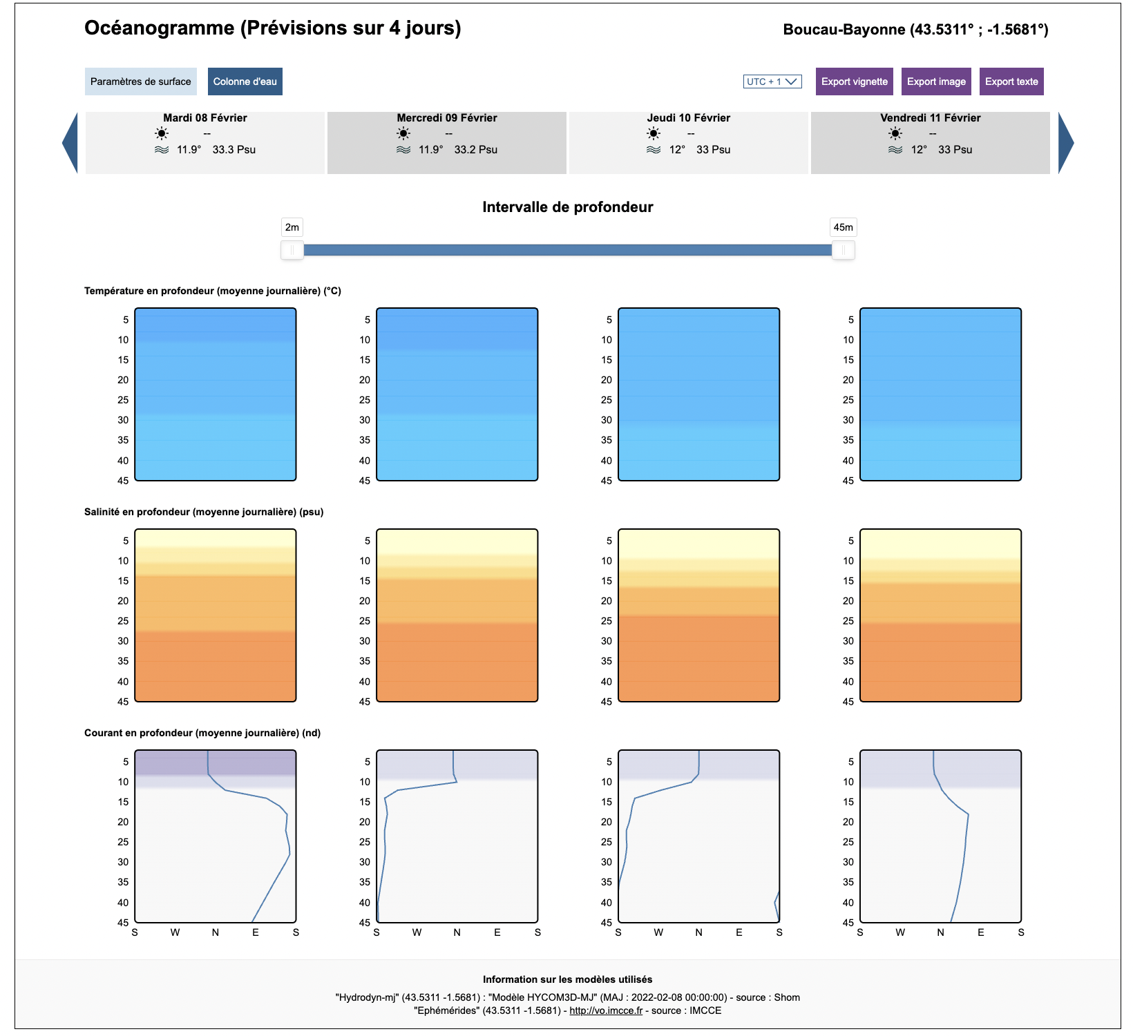
Finally, it is possible to select a day to access detailed forecasts hour by hour.
The information is updated daily (refer to the sources at the bottom of the Oceanogram).
Oceanogram live - up to date:
Taking a look of the oceanogram of the current date bellow:
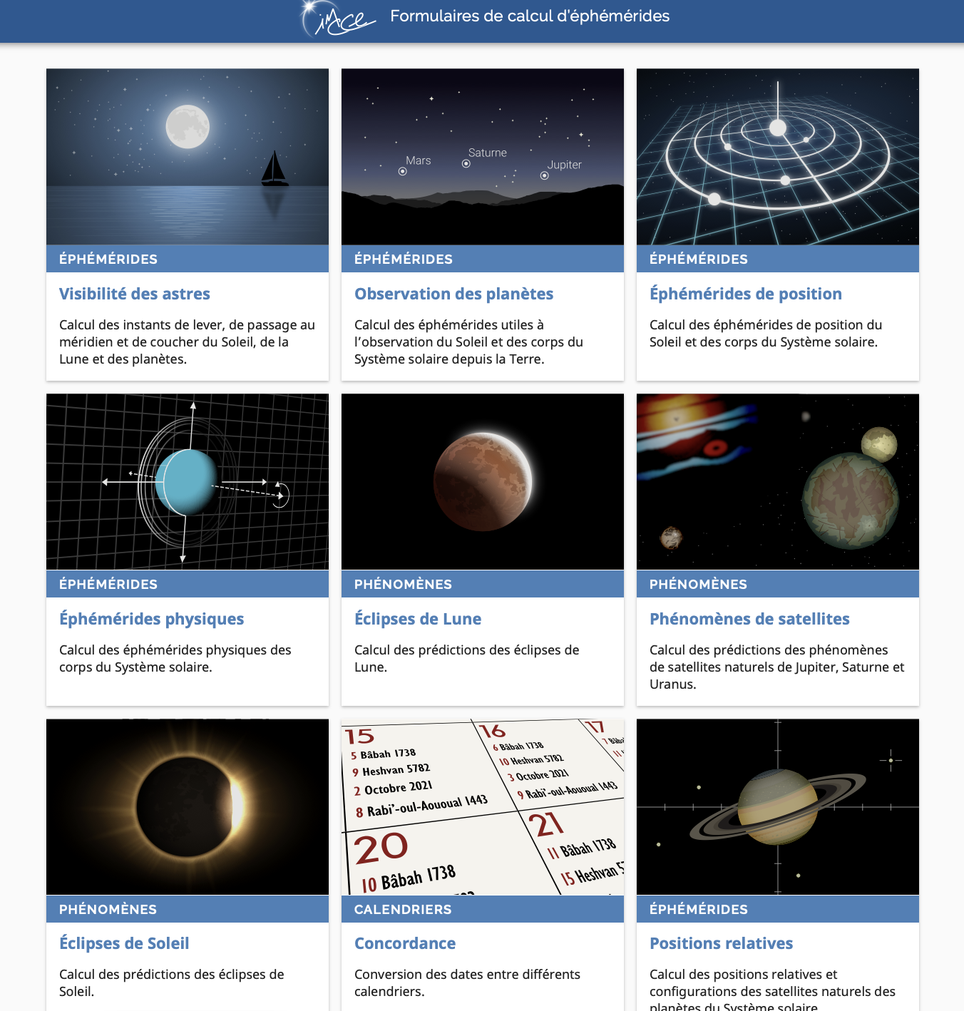
IMCCE
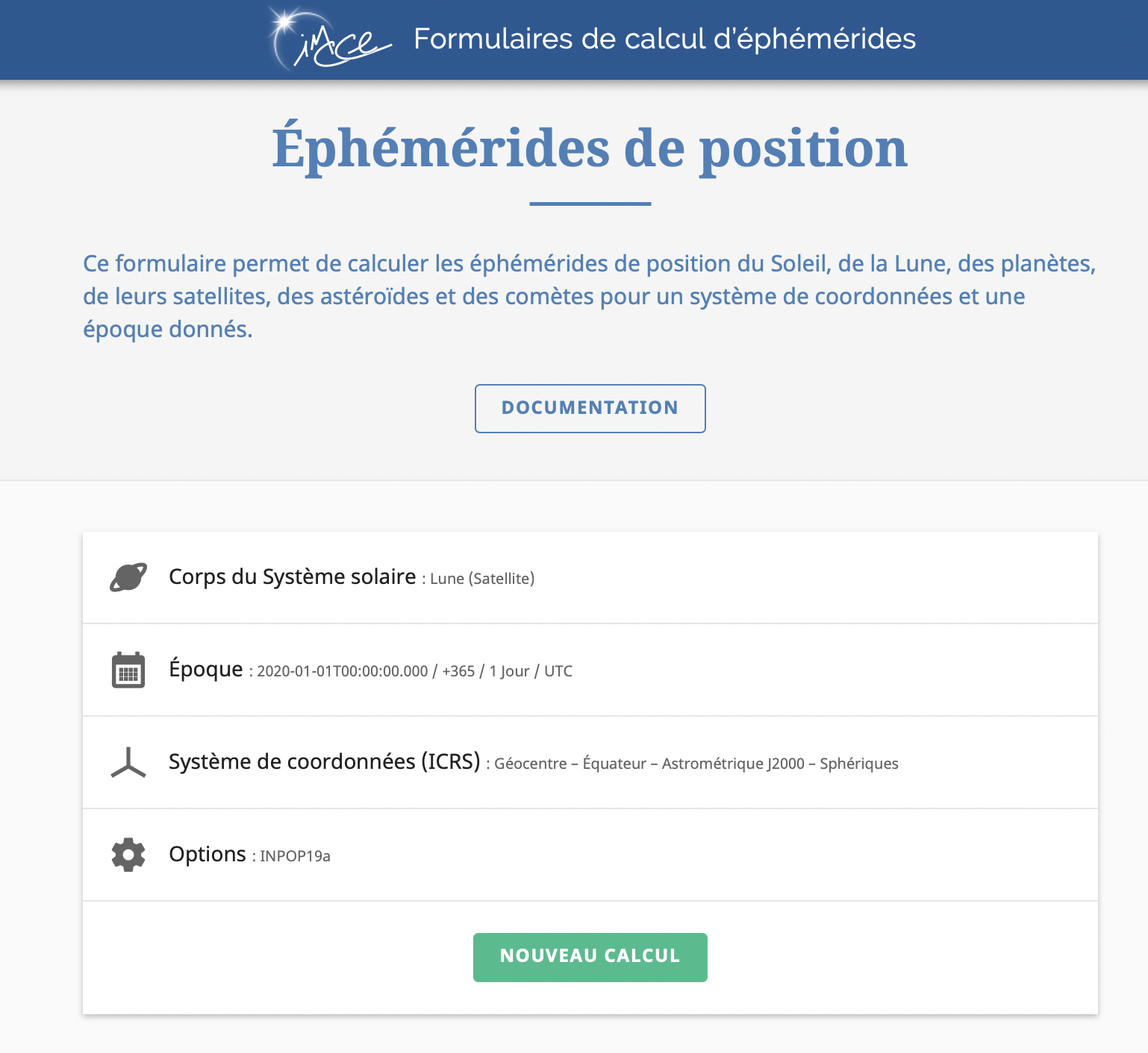
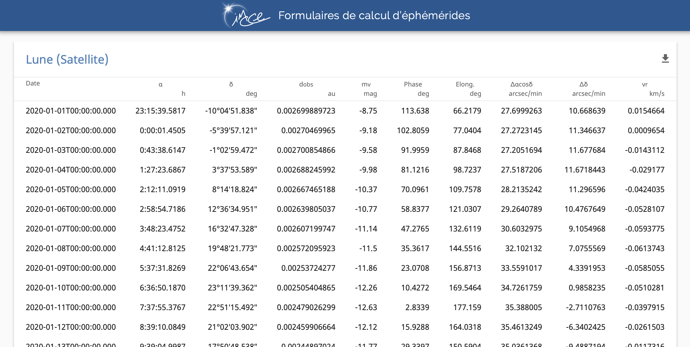
One full year of epheremeris position of the moon and sun data collected on IMCCE website.
The IMCCE is the “Institut de mécanique céleste et de calcul des éphémérides” (IMCCE), Institute for Celestial Mechanics and Computation of Ephemerides.
The “Institut de mécanique céleste et de calcul des éphémérides” (IMCCE), Institute for Celestial Mechanics and Computation of Ephemerides, was created by decree of June 2, 1998 modifying that of the Paris Observatory and replacing the “Service de calcul et de mécanique céleste du Bureau des longitudes”. This decree assigns to the IMCCE within the Observatory a mission of research and a mission of services particularly for the elaboration and dissemination of the ephemerides that it conducts under the auspices of the Bureau des longitudes. The IMCCE is also a joint-research Unit of the French CNRS (UMR 8028) integrated within PSL Research University and associated to the universities UPMC/Sorbonne Université and université de Lille.
Research and Services
The IMCCE has two main activities: a research mission in celestial mechanics (see Research) in its mathematical as well as dynamical aspects, in astrometry and planetology; and a mission of service, especially for the development and dissemination of original ephemerides. IMCCE has also other national services (SNO – Service nationaux d’observation) defined by CNRS/INSU (see Services).
The research works of the Institute are carried out by three research teams:
-
Asteroids, Comets, Meteors and Ephemerides: ACMÉ
-
Astronomy and Dynamic Systems: ASD
-
Planetology and Environments from Ground Astrometry and Space Exploration: PEGASE
These research teams work on different topics related to the dynamics and the solar (or planetary) system, and work together on large scientific projects.
Data on IMCCE Website- Ephemeris Calculation Forms
The data Used
Process of finding maps, localization, extracting and downloading the data as text from Saint Jean de Luz:
OCEAN
Finally I dowloaded and used one full year of hourly validated sea level, collected in Saint-Jean de Luz by this instruments:
- Marégraphes IMAGES
The data downloaded comes in this form:
And I organized it in digital documents, lays of 40cm by 2m50.
MOON & SUN
On the open source website you can select and define the dates, the star and other parameters. The data results comes as a data-board dowloadble as text:
Data on IMCCE Website- Ephemeris Position Calculation